1
Day 1: Reach Jobra
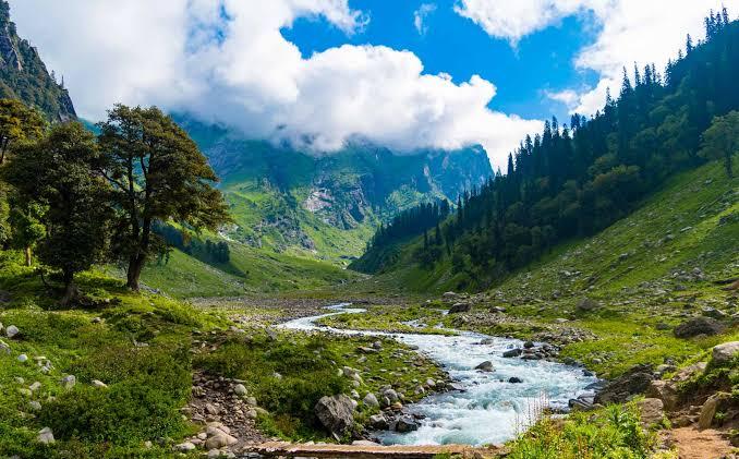
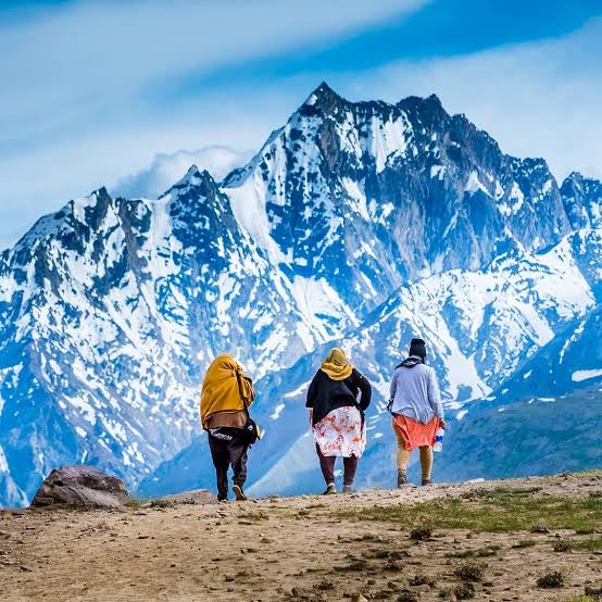
The base camp for the Hampta Pass trek is Jobra. The picturesque drive from Manali, along with 42 hairpin turns, has panoramic views of Kullu valley. The Rani Nallah, which you will trek alongside till it disappears under the snow of Hampta Pass, starts accompanying you from here. From the road head at Jobra, the campsite is a 30-minute trek through a mixed forest of pine, bright green maple trees and luminescent silver birch.
Altitude : 9,379 ft (2,859 m)
Time taken : 2 hours drive from Manali to Jobra; 30-minute trek to Jobra campsite. Reach Prini (Keylinga Inn) by 11.30 am. The cab fare is Rs.2,500 per vehicle. This is not included in the trek fee. It is to be shared by trekkers and paid directly to the driver.
2
Day 2: Jobra to Jwara
Altitude: 9,379 ft (2,859 m) to 11,194 ft (3,412 m)
Time taken: 5 hours, 5 km
Trek gradient: Easy-moderate. Easy walk to Chika for about an hour followed by 2 hours of ascent through a boulder section. Descent for 1-1.5 hours easing off into a level walk.
Jwara is to the right of Chika, and can be identified by a couple of waterfalls in the distance. Head right but stay on the left bank of the river throughout. The initial climb is mainly through stones and boulders. The going is never too difficult. The right bank of the river is laced with dwarf Rhododendrons in the lower and middle region of the mountain and Birch trees grow at the upper end.
3
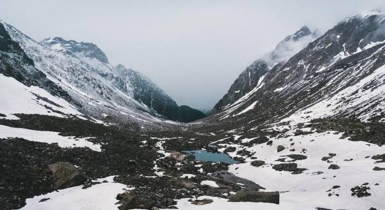
Day 3: Trek from Jwara to Balu Ka Ghera
Altitude : 11,194 ft (3,412 m) to 12,411 ft (3,783 m)
Time taken : 4-5 hours, 4.5 km
Trek gradient : Moderate. Short meadow walk followed by boulder section for a couple of hours, leading to a trail on loose rocks all the way. Very gradual incline through the day.
Walk along the Rani river heading into a rectangular valley. On your way, you will find a variety of tiny flowers – purple, yellow, pink etc. The trees are now left behind. You won’t find them anymore for quite some time. It takes about half an hour to cross the valley. After you come out of Jwara, you need to walk further along. The terrain flattens as you reach Chota Balu ka Ghera where you can rest for a bit and have a quick snack. Then continue further along the river, crossing small snow flows and jumping across rocks.
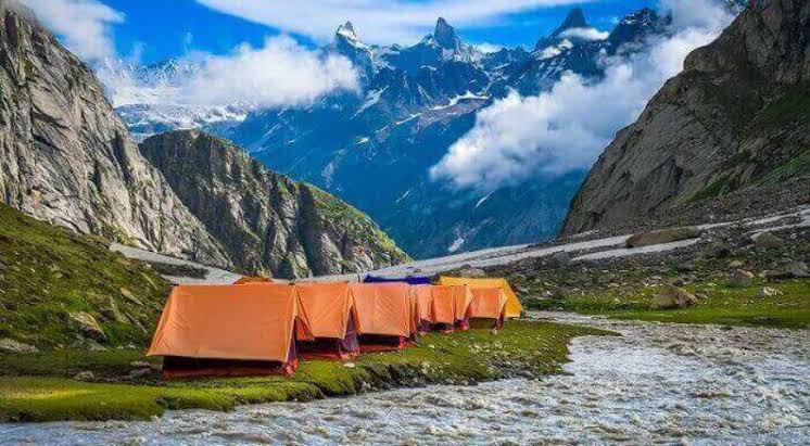
Towards the end, the rocks are quite far apart and jumping across gets tricky. Soon after, you will reach the destination for the day – Balu Ka Ghera or the bed of sand. The ground is formed mainly by the sand and dust brought down by the river.
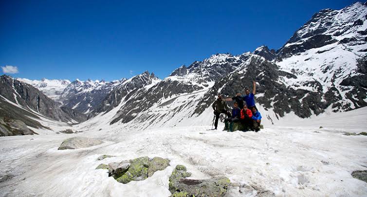
It is level ground and behind you are the mountains you will traverse the next day to cross the Hampta Pass. Pitch your tent and enjoy a beautiful sunset behind the Hanuman Tibba peak. You are now close to 12,500 ft above sea level.
4
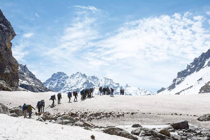
Day 4: Balu Ka Ghera to Shea Goru via Hampta Pass
Altitude : 12,411 ft (3,921 m) to 12,864 ft (3,735 m) via 14,065 ft (4,287 m)
Time taken : 9 hours, 5 km
Trek gradient : Moderate. An hour of gradual ascent after which the trail becomes steep uphill till the pass, interspersed with short descents. 2 hours of steep descent from the pass, easing off into a flat walk.
You begin your day by heading towards the mountains from Balu Ka Ghera. You may get a pleasant surprise with lots of tiny pink and yellow flowers growing by the side of the river. Move along the river for an hour after which you will be above it. At some points, the trail may fade out so be careful not to get lost. Stay with your team. After an hour of a gentle gradient in a rock fall prone area, the climb picks up. This is the first serious incline you will encounter. Half an hour into the climb, you will reach the first plateau. Here you get to see the Deo Tibba peak right in front of you. If you are here during early summer, there is a good chance that this entire section is filled with snow. At other times, you may get only some patches of snow.
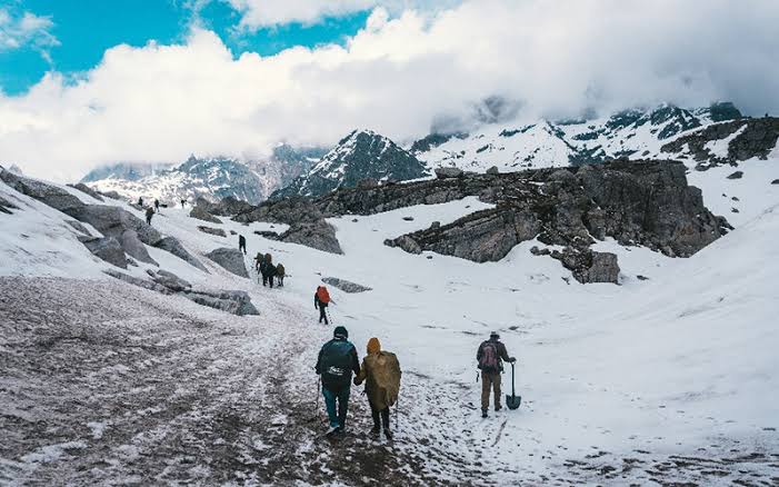
Take a breath, wait for your team to catch up and begin the next ascent. This is another inclined part which has two stages to it and finally ends at the ridge. The climb will take you 20-30 minutes. From the top of the ridge, you will see another parallel one, which is your next destination. Hampta Pass is a bend away from the top of the second ridge.
The descent is slightly trickier than the ascent. It can vary slightly depending on the snow condition too. Sliding down may be an option if there is snow. From the pass, take a turn towards the right. You can see the Lahaul side of the pass below. Go down in a zig-zag route and then stick to the right flank of the mountain. You will have to walk over slippery soil and stones too. In half an hour the first downhill run is done.
5
Day 5: Shea Goru to Chhatru; drive to Chandratal* and back to Chhatru
Altitude : 12,864 ft (3,735 m) to 10,898 ft (3,322 m) to 14,100 ft (4,298 m)
Time taken : 4 – 4.5 hours; 6 km
Trek gradient : Moderate. 2-2.5 hours of walking on moraine and loose rocks on gentle inclines, followed by a descent to Chhatru across a couple of glacial flows.
As you move closer to the road, the descent gets a little tricky. You will need to traverse by the edges of rocks and sometimes it might just be easier to get down into the river/glacier bed below to skip the rocky section and get back up.
There are also a couple of places with slippery soil. So you need to be nimble and hop down them to prevent yourself from sliding.
6
Day 6: Drive from Chhatru to Manali
After an early morning debriefing, bid the Spiti valley goodbye and head back to Manali. The journey from Chhatru to Manali passes through Rohtang Pass and can take up to 4 hours. The scenery all through the route is a treat in itself. Don’t forget to ask our trek leaders to teach you some group games like Hand Uno and Lateral Situations, to play on the way back!
Leave Your Comments